


In Part 1 of this two part series, we discussed the importance of carbon sequestration in climate change mitigation, and how carbon mapping and monitoring can be used to increase sequestration in forests. Part 1 introduced the drivers of demand for finding new ways to innovate mapping and monitoring systems with artificial intelligence (AI) to better protect our forests and the critical services they provide. In Part 2, we will dive further into an exploration of some of the companies, start-ups, and organizations that are harnessing AI to monitor deforestation and drive better business and policy decisions.
Minimizing Deforestation with AI
Illegal logging alone is a huge environmental and economic loss for tropical regions like the Amazon. Illegal logging is associated with billions of dollars of lost revenue each year in addition to depressed timber prices, yet effective strategies to curb illegal deforestation are hard to find (14). Part of this problem is a lack of adequate forest monitoring, and the challenge of “obtaining accurate and consistent spatial data on deforestation” (14). Even with the use of satellite imagery and surveillance of forest canopies, ‘filtering large amounts of data can be slow, labor intensive, and expensive” (14). However, harnessing AI serves as a promising innovation for enhancing the accuracy of forest monitoring, with the potential to be adapted to the Amazon basin and other tropical regions through adequate government support, robust policy frameworks, and international cooperation (14).
IBM Brazil utilizes sensor networks with analytics driven software which can process over 10,000 data points per second, measuring carbon levels, soil moisture, humidity, and atmospheric pressure in Brazil (14). Speeding up the data analysis process by
combining satellite imagery with AI greatly expands the technical capacity to map and monitor Brazilian lands, allowing conservationists and researchers to predict drought and forest fires
and monitor how rainforests respond to deforestation and climate change (14).
AI can also help build the range and capacity for forest monitoring, an example being Sao Paulo-based MapBiomas, which uses “remote sensing, GIS, and cloud-based computing to generate a historical map series of land cover and use in Brazil, using satellite images to identify pixel patterns for different types of activities leading to deforestation” (14). AI helps MapBiomas build capacity by working through networks of NGOs, universities, and companies to bring together specialists in remote sensing and information technology.
The World Resources Institute (WRI) “has used spatial modeling software and an artificial neural network architecture to map the links between past forest loss and drivers in these landscapes” (14). Machine learning is utilized so that as past land-use data is inputted, “the model ‘learns’ and adapts until it arrives at the most accurate linkages between past loss and drivers” (14). The model is then able to produce a map showing areas at high risk for forest loss by ranking the influence of various drivers in those landscapes (14).

Source: www.worldwildlife.org
Companies Using AI for Environmental Mapping and Monitoring
Orbital Insight is a startup based in California that is working with the World Resources Institute (WRI) to identify areas around the world where virgin rainforest is being replaced with new roads, buildings, and palm oil plantations. Orbital Insight’s mission is to drive better business and policy decisions by providing organizations with location data to help them discover, measure, and monitor activity around the world and to analyze environmental trends at scale (13). Orbital Insight analyzes billions of geospatial data points with machine learning, automating “the most difficult steps of deriving insights, allowing you to answer many challenging geospatial questions'' (13). WRI and Orbital Insight have been working together since 2015 “to find new applications of computer vision and deep learning that will support Global Forest Watch in better monitoring of the world’s forests'' (21). Their teams are working to map palm oil plantations across tropical countries in an attempt to tackle commodity-driven deforestation (21). While with traditional methods it can be difficult to differentiate palm plantations from other forms of tree cover, deep learning allowed GFW to develop a method for automatically detecting palm plantations using satellite imagery (21). This is because traditional methods “rely on the characteristics of individual pixels,” while deep learning “looks at the broader context of an image and can differentiate plantations based on their color, size, shape, and pattern” (21).
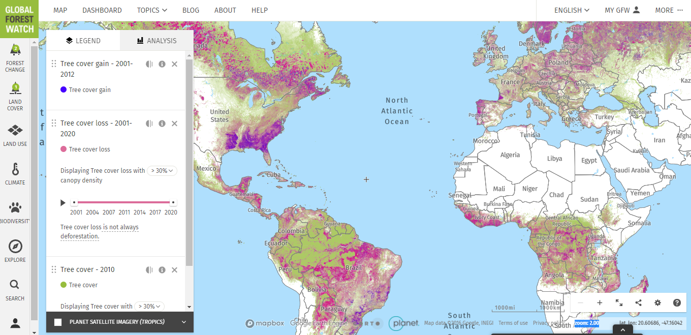
Total Tree cover gain and loss. Source: Global Forest Watch https://www.globalforestwatch.org/map/
3vGeomatics is a startup through a project for the Canadian Space Agency, that is using a remote sensing radar satellite-based technology to monitor thawing permafrost. Permafrost is ground that continuously remains frozen, covering large regions of the earth at mostly high latitudes, and when thawed, releases thousands of years worth of stored carbon into the atmosphere.
"Unlike optical satellite images, radar can penetrate through clouds and can work equally effective at night, leading to 98% image acquisition reliability." (20)
3vGeomatics is helping assess areas of stability and reduce risks associated with melting permafrost in high latitude environments by measuring ground and infrastructure displacement. In places like the Arctic, “changing permafrost is a reality that ... communities have to face” (20). 3vGeomatics is applying their developed technology to help monitor these changes caused by shifting permafrost, through community planning, building stability in infrastructure, and others (20).
NCX, a partner of Microsoft’s AI for Earth program, is “using aerial imagery and AI to survey forests at a national scale, transforming how conservationists and landowners measure and monitor forests'' (16). NCX takes high-resolution satellite imagery and stores it in Microsoft Azure, where it is “paired with field data from the US Forest Service to train machine-learning models'' which are then applied to terabytes of images to produce a “high-resolution, tree level map” leading to improved insights for forest managers (21).
“ Conservationists, governments, and landowners can use these maps to...develop sustainable management plans for a fraction of the time and cost of traditional forest surveys”
Reducing the amount of deforestation taking place in forests worldwide is all part of the global effort to curb emissions, mitigate climate change, conserve biodiversity, and protect and enforce the livelihood and environmental justice of all people who inhabit this planet. “Based on the directives given by the Intergovernmental Panel on Climate Change, and the commitment of countries to their NDCs, there is an urgent need to provide additional guidance on the design of forest monitoring systems'' (6). This additional guidance can be provided by fitting monitoring and mapping systems with AI in new and innovative ways. Though AI is far from the end-all-meets-all solution to solving the climate crisis, if linked to effective policies for conservation and sustainability, as well as “better law enforcement within and across borders” it holds the potential for real impact (14). Implementing artificial intelligence solutions holds a bright future in forest mapping/monitoring and carbon sequestration measures, demonstrating the potential to revolutionize forest management and the market for carbon capture.
Sources:
https://www.nature.com/articles/s41598-019-54386-6
https://cbmjournal.biomedcentral.com/articles/10.1186/1750-0680-4-2
https://people.csail.mit.edu/lucasl/assets/files/ai_forest_inventories.pdf
https://www.barry-callebaut.com/en-US/group/media/news-stories/artificial-intelligence-against-deforestation
https://www.forestcarbonpartnership.org/sites/fcp/files/assessment_of_innovative_technologies_and_their_readiness_for_rs_based_estimation_of_forest_carbon_stocks_and_dynamics.pdf
https://cacm.acm.org/magazines/2020/11/248202-estimating-amazon-carbon-stock-using-ai-based-remote-sensing/fulltext
https://unfccc.int/process-and-meetings/the-paris-agreement/nationally-determined-contributions-ndcs/nationally-determined-contributions-ndcs
http://www.fao.org/state-of-forests/en/
https://www.forestresearch.gov.uk/tools-and-resources/statistics/forestry-statistics/forestry-statistics-2018/uk-forests-and-climate-change/carbon-sequestration/
https://www.wri.org/blog/2020/01/10-big-changes-forests-over-last-decade
https://storymaps.arcgis.com/stories/6740fb49099649e78d5ccf543aed4165
https://pachama.com
https://orbitalinsight.com
https://theglobalobservatory.org/2020/11/how-can-artificial-intelligence-help-curb-deforestation-amazon/
https://blogs.nvidia.com/blog/2020/04/22/geospatial-ai-earth-day
https://www.microsoft.com/en-us/ai/ai-for-earth-ncx
http://www.fao.org/redd/areas-of-work/national-forest-monitoring-system/en/
https://www.weforum.org/agenda/2018/09/ai-can-help-us-map-forests-down-to-each-tree/
https://www.mdpi.com/journal/remotesensing/special_issues/AI_forest
https://3vgeomatics.com/industries/permafrost/
https://www.globalforestwatch.org/blog/data-and-research/artificial-intelligence-helps-distinguish-the-forest-from-the-trees-part-1/